
Exporting screenshots
Save the current 3D view as a high-resolution PNG, with or without the legend and with a transparent background, ready for reports and slides.
You will learn
- Export the view as a PNG image.
- Choose the resolution, legend and background.
- Prepare a clean view for a figure.
Prerequisites
Data for this tutorial
Nanda Devi massif, SRTM (real terrain) Download nanda-devi-srtm-1arcsec.tif
- Format
- GeoTIFF, 1 band, Int16, Deflate, tiled
- CRS
- EPSG:4326 (WGS 84, longitude/latitude)
- Content
- Elevations 2285 to 7801 m above the EGM96 geoid; lon 79.7276 to 79.9776, lat 30.2279 to 30.4779
- In Orbis3D
- Data panel ▸ Sample data ▸ Nanda Devi massif, SRTM (real terrain) ▸ Load
- Licence
- SRTM 1 arc-second, NASA/USGS, public domain
Synthetic samples are CC0 1.0; the SRTM sample is public domain. About the datasets
The task
You need a crisp image of the Nanda Devi terrain with its legend for a report.
Steps
- Set up the view: colours, exaggeration, lighting and the camera position. Everything you see in the viewport is kept.
- In the Export tab, under Image, choose:
- Resolution: 1× to 4× the size of the viewport. 2× of a 1,000-pixel-wide viewport gives a 2,000-pixel image. The graphics card sets the upper limit (at most 8,192 pixels a side).
- Add the legend: draws the legend of the active layer in the lower-left corner.
- Transparent background: leaves the background empty, for placing the terrain on a slide.
- Click Export PNG, or use the camera button in the toolbar or Export ▸ Export view as PNG (they use the same options).
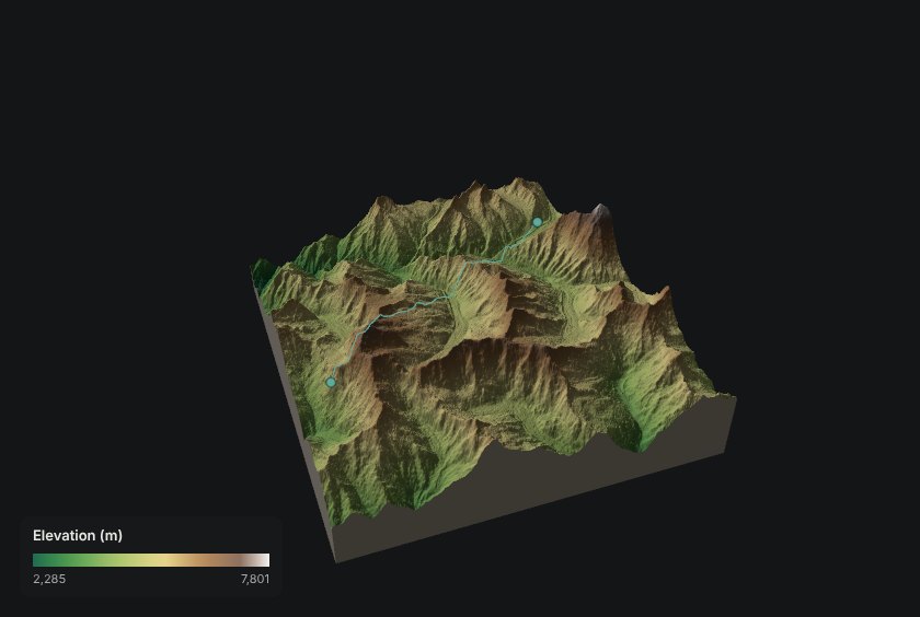
What is in the image
- Only the 3D view: no panels, buttons, tooltips or notifications.
- The current camera, exaggeration, colours, lighting, shadows, contours, draped images and measurement or profile lines.
- The legend, if chosen, at a size that matches the resolution.
A PNG of the terrain at the chosen resolution, with the legend in the corner. A message gives the pixel size of the file.
Common mistakes
- Resolution smaller than chosen. The graphics card limits render sizes; Orbis3D reduces the scale to fit.
- Legend missing. The legend belongs to the active, visible layer and is not drawn for the solid colour mode.